Plate Tectonics
- In 1912, climatologist Alfred Wegener began publishing his ideas on the movement of continents and named it ⇒ Continental Drift
- He put together several lines of evidence
- Glacial deposits in tropical areas
- Desert sand deposits in moist regions
- Coal deposits in Antartica
- Fossil deposits found across different continents
- Wegener proposed Pangea, a single supercontinent
- And the hypothesis of Continental Drift
- But he struggled to get support for it
Evidence of Plate Tectonics
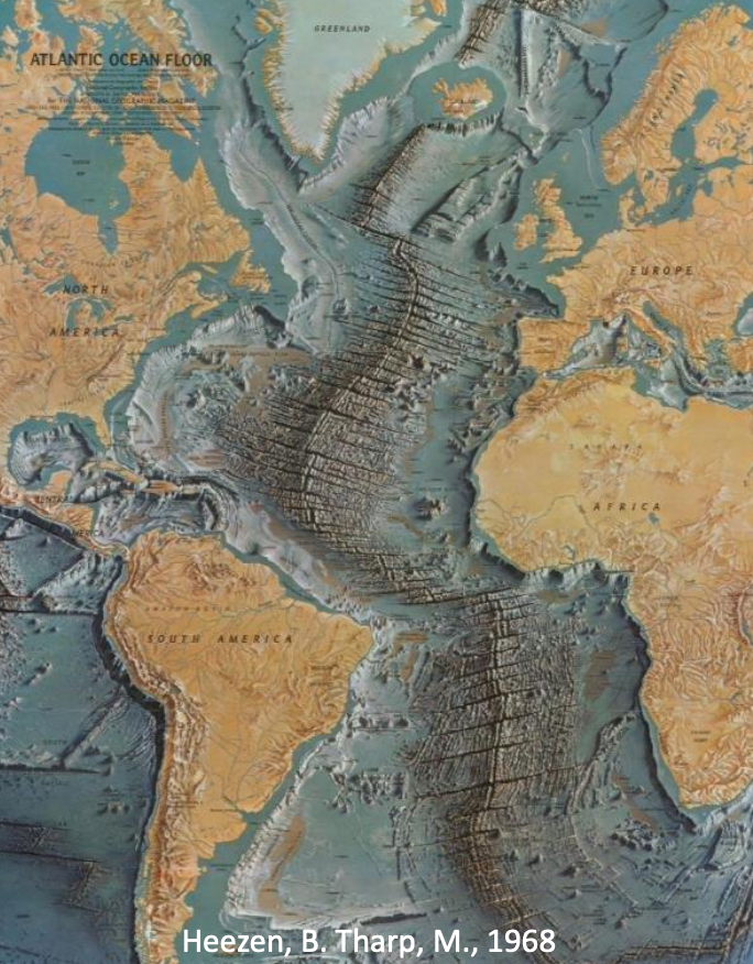
- Sea floor topography - Ridges, trenches, volcanoes and not just flat sediments
- Paleomagnetism and seafloor spreading - Ferromagnesian (magnetite) minerals in magma align with Earth’s magnetic field upon cooling and formation of seafloor basalts
- On both sides of the mid-ocean ridges, stripes of varying intensities of magnetism (some stronger, some weak)
- Due to reversals in polarity of Earth’s magnetic field and spreading of existing seafloor and creation of new seafloor
- Age of ocean floor - dates of basalts are symmetrical across ridges with youngest at ridges and progressively older as you move away from the ridge
- Seafloor is rarely older than 200 million years
- Sediments show same trend with thicker and older deposits as you move away from ridges
- Continental rocks contain much older ocean floor and one can better study the magnetic orientation of those rocks in 3 directions
- Direction of needle points to magnetic N and dip of needle varies with latitude
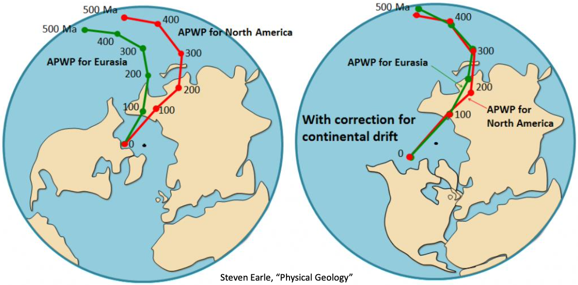
- Polar-wander curves - Rocks of different ages on a continent can point to various magnetic pole positions and make it look like the magnetic pole has wandered over the years
Recap:
- Seafloor topography revealed pronounced structure and relief
- Paleomagnetism helped reveal seafloor spreading occurs
- Age of seafloor confirmed spreading must occur
- Polar0wander curves suggest and track the movement of continents
How Plates Move
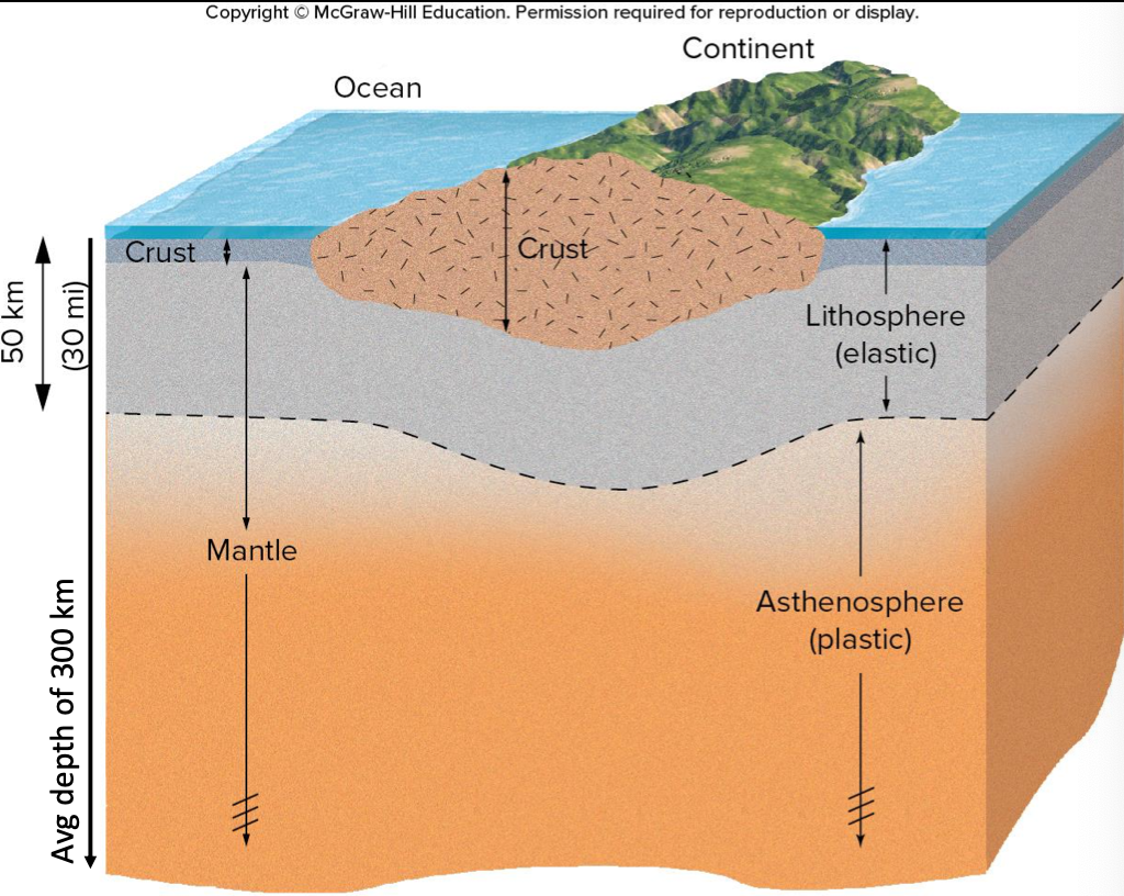
- Lithosphere - consists of crust and upper mantle; acts brittle and elastic
- Asthenosphere - only mantle; Rocks flow plastically under high temperature and moderate confining pressure
- Below the asthenosphere pressure increases and mantle becomes rigid again
Tectonic Plates & Boundaries
- Volcanic activity is not exactly random
- Earthquake locations are not random either
⇒ They occur at plate boundaries
- Only a few large plates, some smaller ones, and likely more will be found
There are 3 types of plate boundaries
- Divergent
- Convergent
- Transform
Divergent Plate Boundaries
Lithospheric plates move apart (or diverge), causing tensile stress and a rift valley or rift zone forms
- Resulting less pressure allows for melting in astenosphere
- Magma upwells from asthenosphere to surface
Volcanoes and earthquakes are common!
Two types of divergent plate boundaries:
- Oceanic Ridges
- Continental Rifts
Oceanic Ridge
Example: Mid-Atlantic Ridge
Continental Rift
- Most ocean basins likely formed from continental rifting
- Either the pulling apart of plates or rising magma creates the rift valley
- Lava flows into rift floor, creating new crust
- If rifting continues, it will fill with water and form a sea or ocean
- And eventually become a mid-ocean ridge
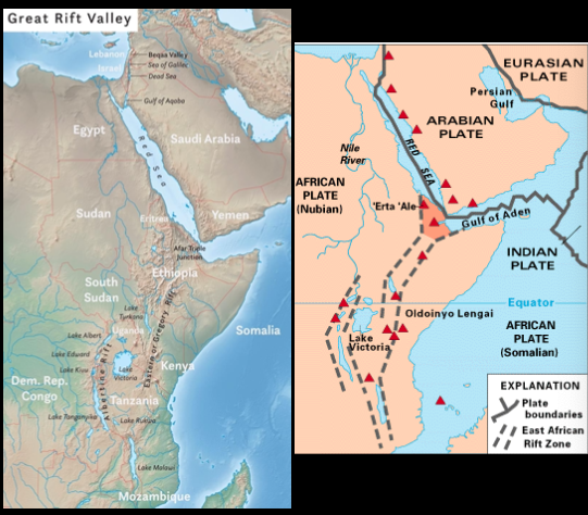
Afar Triple Junction of
- Red Sea Rift
- Aden Ridge
- East African Rift
Continental rifting and seafloor spreading leading to creation of ocean basins (1-2 cm/year)
African plate was once one whole plate, but now divided into Nubian, Somalian, and Arabian protoplates
In 10 million years, the whole rift will be submerged
Example: The Red Sea
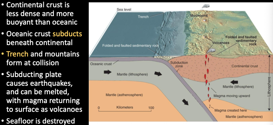
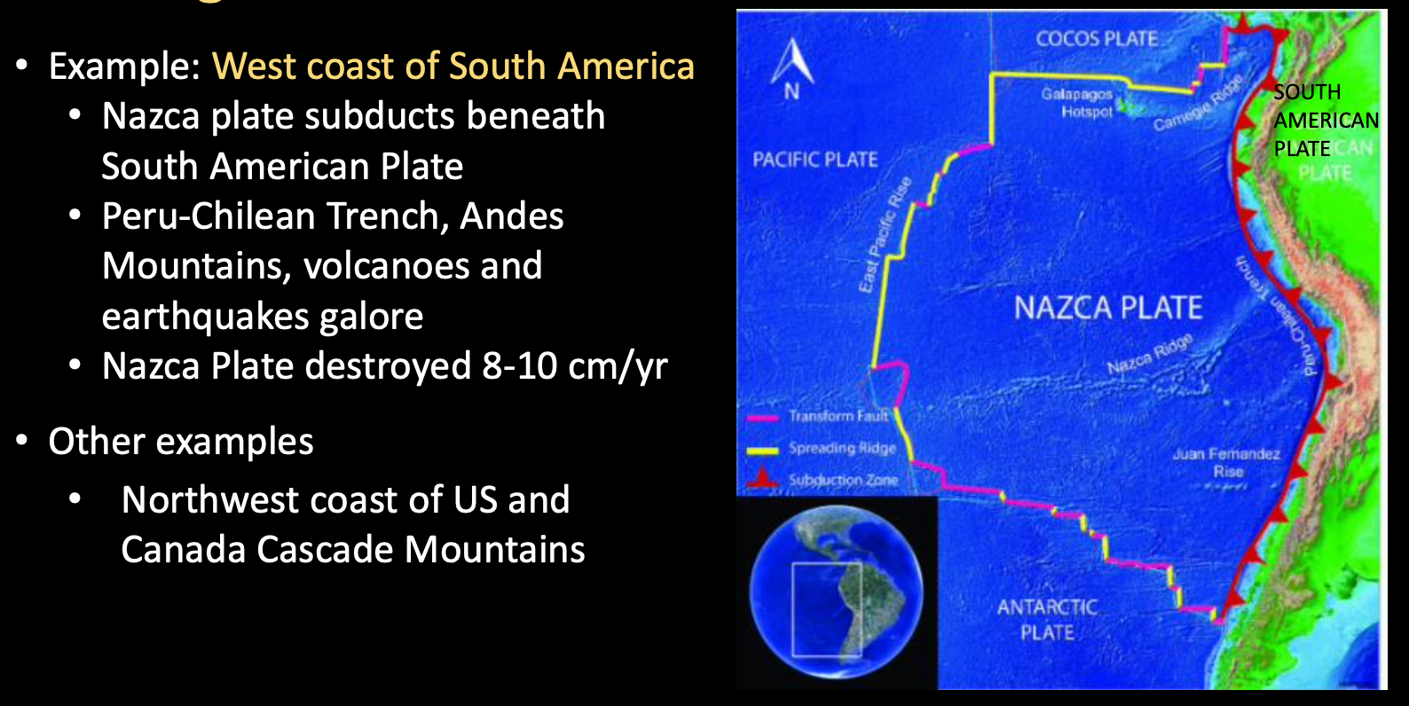
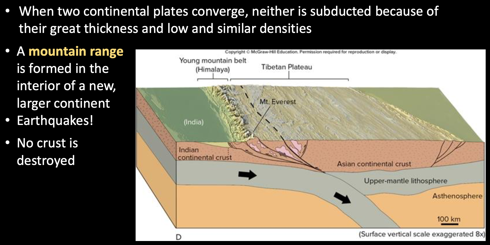
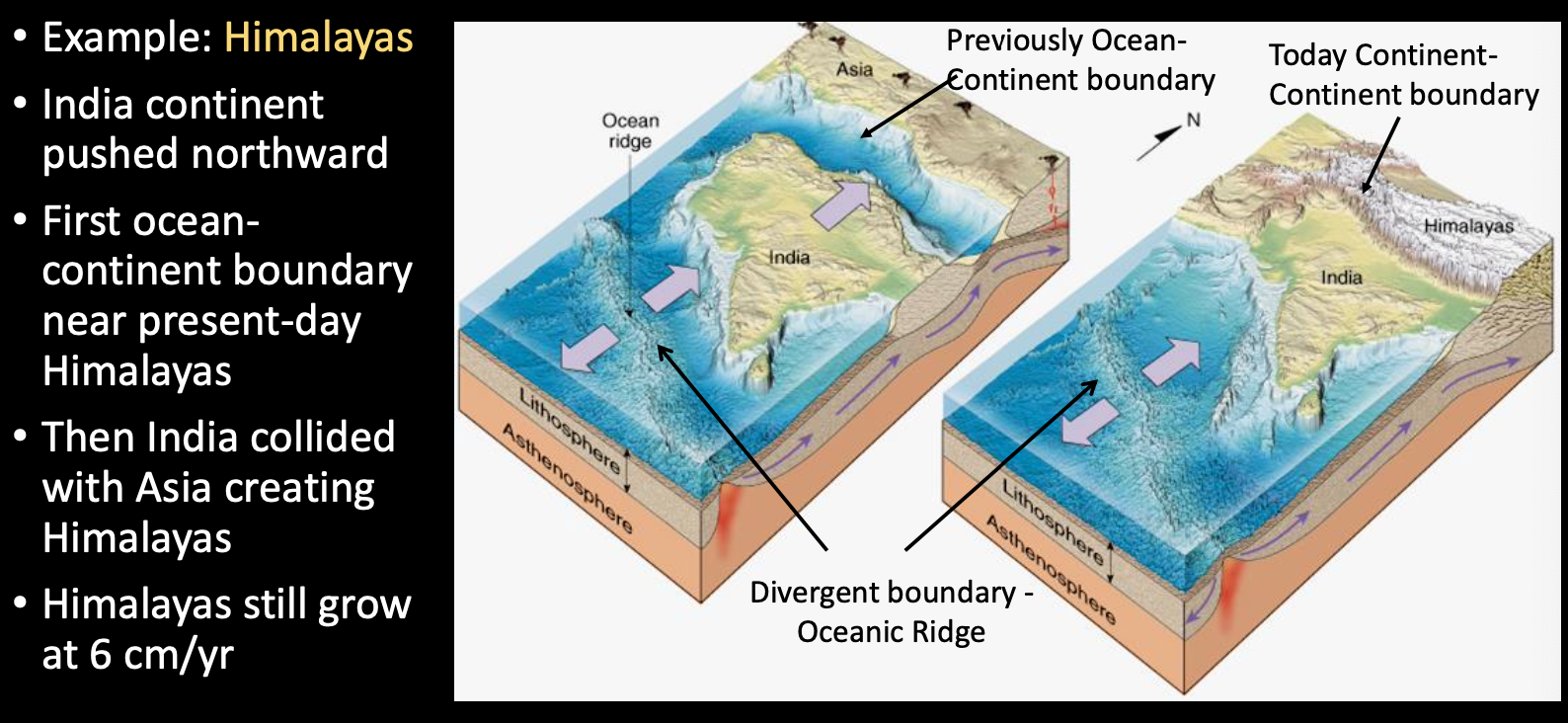
Convergent Plate Boundaries
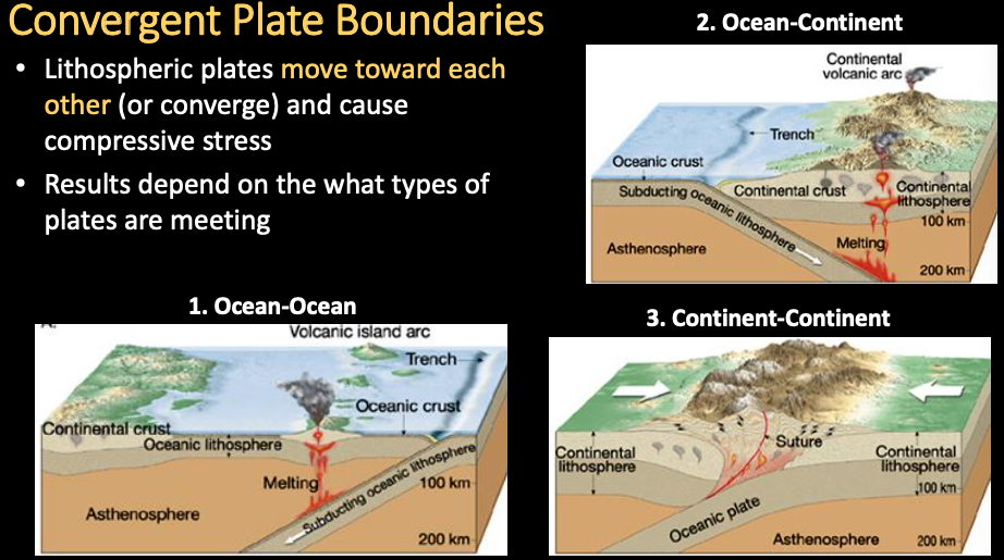
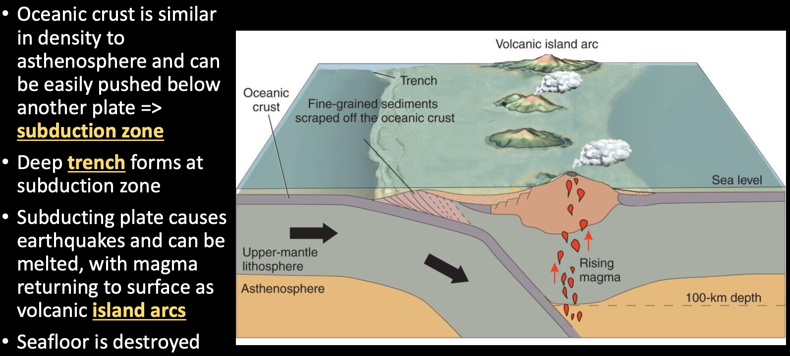
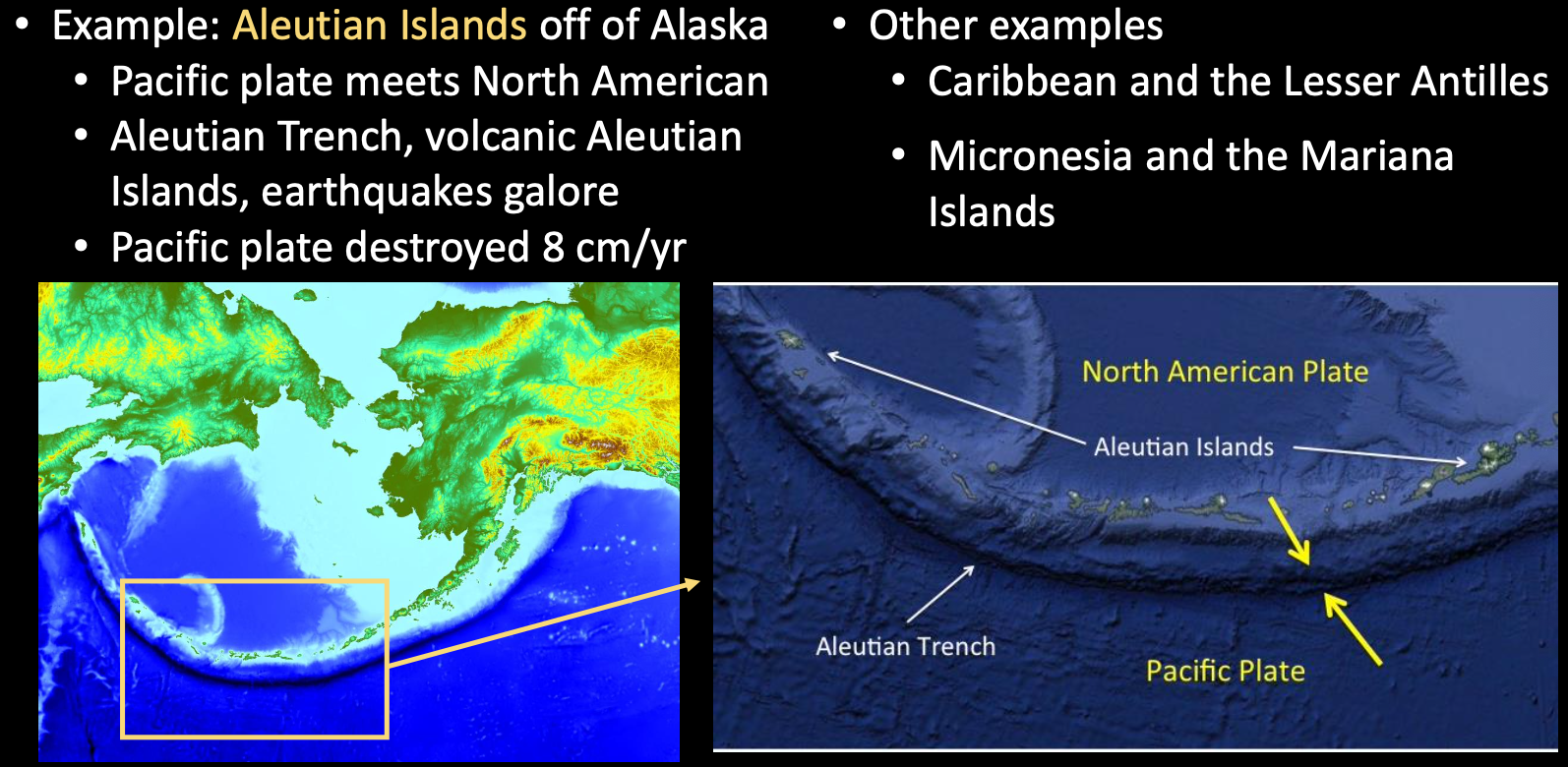
Ocean-Ocean
Ocean-Continent
Continent-Continent
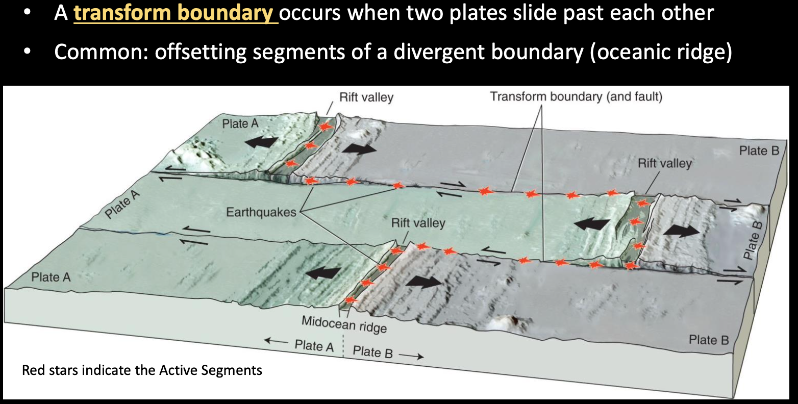
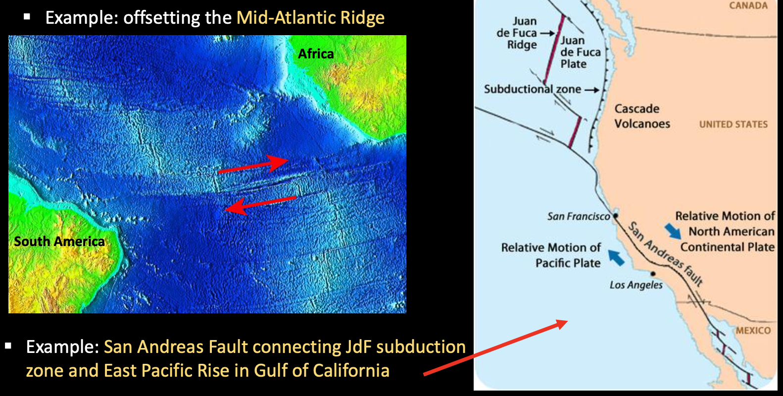
Transform Plate Boundaries
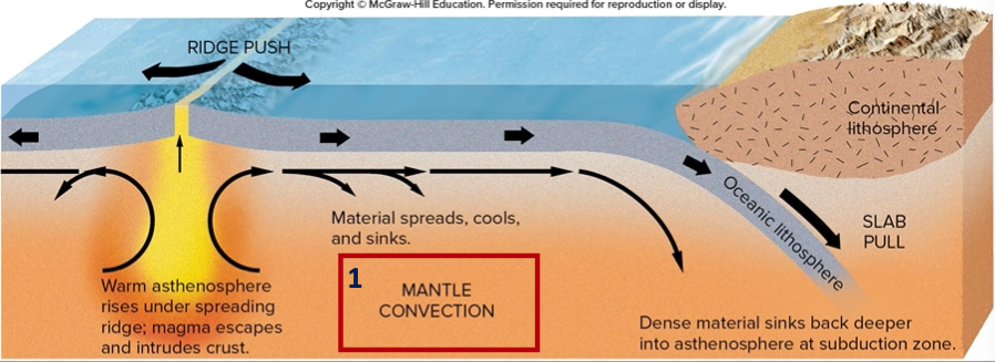
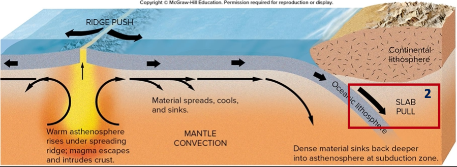
How do plates move?
We do not know for sure!
Three models exist:
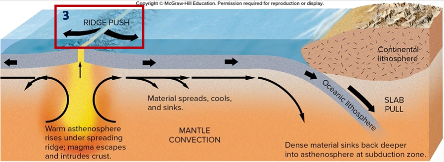
- Mantle Convection - Some rising magma at spreading centers spreads in upper asthenosphere, dragging overlying lithosphere with it and keeping spreading center open, until the dense oceanic crust sub-ducts. Creates convection cells within mantle.
- Slab-pull Model - Starts at the subduction zone with the dense oceanic crust sub-ducting and pulling the plate over, keeping spreading center open.
- Ridge Push Model - Starts at the topographic highs at spreading center with lithosphere sliding off aided by rising magma pushing them off and dragging asthenosphere with it
How Long and How Fast?
- Oceanic crust only tells us up to 2 MYA, but continental rocks show evidence of plate tectonics back to ~3BYA
- Velocities and / or directions measured by
- Polar-wander curves
- Seafloor spreading distance and dates
- Hot spots - stable volcanic area not a plate boundary
- Show direction (and shifts) and velocity
- Hawaii is a classic example
- Overall global average of plate movement is…
- 2-3 cm/year, which over 100 million years would be…
- 2000 km! ~Here to Florida or Winnipeg
- 2-3 cm/year, which over 100 million years would be…